National Scenic Byway Located in Southeast
Tennessee
This Beautiful
mountain highway, named after the Cherokee National Forest in
Tennessee and the Nantahala National Forest in North Carolina; was in the planning and construction
stages for more than 38 years. The Skyway was officially dedicated on
October 12th. 1996 by Congressman John J. Duncan and other dignitaries at the Unicoi
Crest Overlook near the TN/NC stateline.
During
the 38 years of planning and construction, the only access to
Robbinsville was via a crooked gravel Forest Service road, which took
over two hours to travel. Now you can literally drive into the clouds
above Tellico Plains and Robbinsville. Wagon trains have traveled to
Robbinsville for nearly all of the 38 years, to stress the need for a
good road across the mountains.
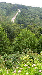
Maximum elevation along the 51 mile stretch of road is above 5,400 at
its highest point. It crosses near Haw Knob elevation 5,472 feet the highest
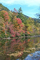
point in Monroe County. On either side of the State line you will be
traveling by the rapids of mountain streams, alongside Tellico River,
and nearby North River
and Citico Creek on the Tennessee side; and Santeetlah Creek on the
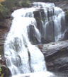
North Carolina side. Bald River Falls is just a short drive off the
skyway.
About
22 miles East of Tellico Plains, you will travel across a 700 foot
bridge at the 4,000 foot elevation. The Charles Hall Bridge is one of the highest major
bridges in the Southeast, named after former Tellico Plains Mayor
Charles Hall, the person instrumental in getting the skyway completed.
You will not see a service station or
restaurant on the Skyway, but stations are located in Tellico and
Robbinsville. Restaurants located in Tellico are: The Tellico Beach Drive-In and Hardee's
and Subway and Tellico Pizza, and the Town Square Cafe are located in
the town of Tellico
Plains.
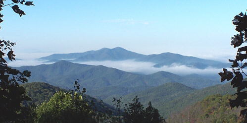
Unicoi Crest Overlook Near TN/NC Line Where
the Skyway Was Dedicated in 1996
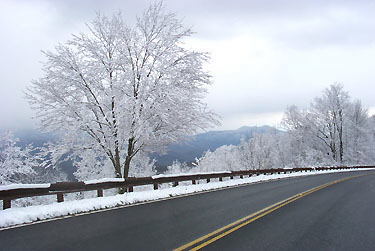
Late Winter Snow on the Skyway
Near Lake View Overlook
Photos on These Cherohala
Skyway Pages
By Tellico Plains Native - Jack Waters Copyright 1997-2009